Part I: Mountains & Flowers & Such
The places we live & recreate are on Native lands. The spaces that I’m writing about are Native lands. I am not sure of the best way to acknowledge territory in a truly meaningful way, but I am trying to learn.
“If we think of territorial acknowledgments as sites of potential disruption, they can be transformative acts that to some extent undo Indigenous erasure. I believe this is true as long as these acknowledgments discomfit both those speaking and hearing the words. The fact of Indigenous presence should force non-Indigenous peoples to confront their own place on these lands.” – Chelsea Vowel, Métis, Beyond Territorial Acknowledgements

From Native-land.ca. Read their disclaimer regarding this map.
And so, I feel irresponsible writing about my home without this acknowledgment & recognition that I have more to learn & do beyond simply acknowledging. I’m additionally worried due to concerns about the land being further damaged due to oil & gas development, subdivisions, overuse, and recreation (yes, recreation). I’m not a NIMBY in regards to recreation—but what really is responsible recreation beyond “Leave No Trace” principles? We know there are damning consequences when everyone covets the flawlessly filtered Instagram photo of Antelope Canyon without respecting Navajo culture. That’s just one example. I don’t think anyone wants a bunch of other people to come & trample on the places that we love.
It’s complicated to write about & take photos of beautiful places that you want to hide for yourself, while still recognizing that these places are not really “mine” either.
So, I’ve decided to share a handful of our Montana summer adventures, knowing well & good that only a small handful of folks will actually read this. Additionally, there are all sorts of sites & apps that give detailed directions & information on these peaks. So, I’m not outlining specific routes or sharing maps. Organizations like Natives Outdoors are working on giving mountains back their Indigenous names. If I find Native names for the peaks available, I will share them here. I didn’t have much luck finding Indigenous names for this group of peaks outlined below. Needless to say, too many mountain peaks (and ranges) are named after white dudes & you can assume (almost) every name listed here is as well.
Bridger Baldy & Saddle Peak

Looking southwest from the “real” summit of Bridger Baldy.
The Bridger Range (yep, named after a white dude) is easily accessed on the West, town side of Bozeman, & the sunny south-facing ridge means snow melts earlier in the spring. We’ve climbed all the peaks in the range, most a few times as they are a good spring/early summer ass-kicker with a rough average of 3500 feet gain in elevation. The mountains are straightforward & most with a few trail options to the top. Due to easy access to trailheads & little if any route finding, they are popular & often busy with hikers, trail runners, and occasional mountain bikers. Almost every person has at least three dogs that are never on-leash & “never” jump on anyone or start dog-fights (except when they do). That being said, most folks on the trail are friendly so I can’t complain too much except when I see small plastic bags of dog poop laying on the side of the trail. Come on, people.
We prefer to access Bridger Baldy from Sypes Canyon, which avoids the more popular “M” trail & has lovely views from the Bridger foothills trail.
Our hike up Saddle Peak (north of Bridger Baldy) ended up being shockingly chilly with at least 500 feet of deep post-holing to the summit. Fortunately, some trail runners ahead of us punched out part of the path.


Any of the Bridger peaks offer gorgeous views of the Crazies, Absarokas, Gallatins, Madisons, and Tobacco Root ranges.
2. False Summit of Mt. Ellis


This is another “town” hike if you will, that we’ve only done spring or early summer. Due to snow levels & our lack of motivation to bring snowshoes, we’ve only ever gone to the false summit of Mt. Ellis (which is really a large hill). There is a road that meanders through a gorgeous field of wildflowers before narrowing to a trail to the top. The false summit also provides views of Bozeman itself, as well as the Bridgers & other surrounding ranges. If you can’t hike far, just wander around the wildflower fields bursting with Balsamroot yellow.
3. Sphinx Peak


We loved Sphinx the first time we climbed it, so decided to climb it again in June. Sphinx has a very characteristic shape & is set apart from any other peaks in the Madison range. It is accessed from south of Ennis at the Bear Creek trailhead and campground. You’ll likely see few other people & an occasional horse. This is prime grizzly bear country (eh hmm, Bear Creek), although we’ve never encountered one ourselves in this area.
*Side note: Don’t ever do the North Fork of Bear Creek loop early in the spring which continues beyond the pass below Sphinx. That’s another story for another day, but it ended up in some sketchy log-crawling creek crossings, clinging onto the side of a wet, mossy embankment, a fresh elk carcass, and running down a hill yelling with our bear spray ready to fire.
But, back to Sphinx. Take the trail to Helmet Pass, before finding a social trail along the north side of the main gully leading to the summit. We were fortunate to climb when there was still enough (but not too much) snow, which provided a lovely glissade/butt slide down. Note that the photos above are on the descent from Sphinx, looking over at the much lower but dramatic Helmet Peak.
The only other people we encountered were a guy & I assume his teenage daughter. He asked in a non-friendly way if we were “from around here.” Can everyone just please fuck off with this question unless you have some genuine reason to ask (which you probably don’t)? Thanks.
But my irritation with that guy didn’t last long as we lounged on the summit, overlooking other peaks we’ve climbed to the north—Lone Peak, Gallatin, & Wilson, and that we would climb later in the summer in the Taylor Hilgard section of the Madison.
4. (Almost) Birdtail Mountain


This mountain is technically unnamed and is the mountain sitting just north of Choteau Mountain on the Rocky Mountain Front. It is also known as “Guthrie Peak” after the late author, A.B. Guthrie. Birdtail is just a more creative name (also: not a dead guy). Like many of the mountains on the Front, there are rarely trails leading to the summit (or any trails at all), occasional bushwhacking, and almost always some wind. This country also requires you to carry enough water for the day since the riverbed was bone dry.
I’ve climbed most of the peaks on the Front from Walling Reef to Sawtooth, but Birdtail & Square (the unnamed peak north of Birdtail) were (& are) still on my list. We picked an unfortunate day of intermittent squall and gale-force winds. We made it to the false (North) summit of Birdtail which involved some crawling and a nearly lost hat before we decided to descend before being flattened by the gusts. But we still saw lovely views of the Front & Bob Marshall Wilderness as well as the ever-resilient Jones Columbine growing out of the scree. If I was a flower, I probably wouldn’t be a Jones Columbine.
5. Elkhorn & Crow Peaks

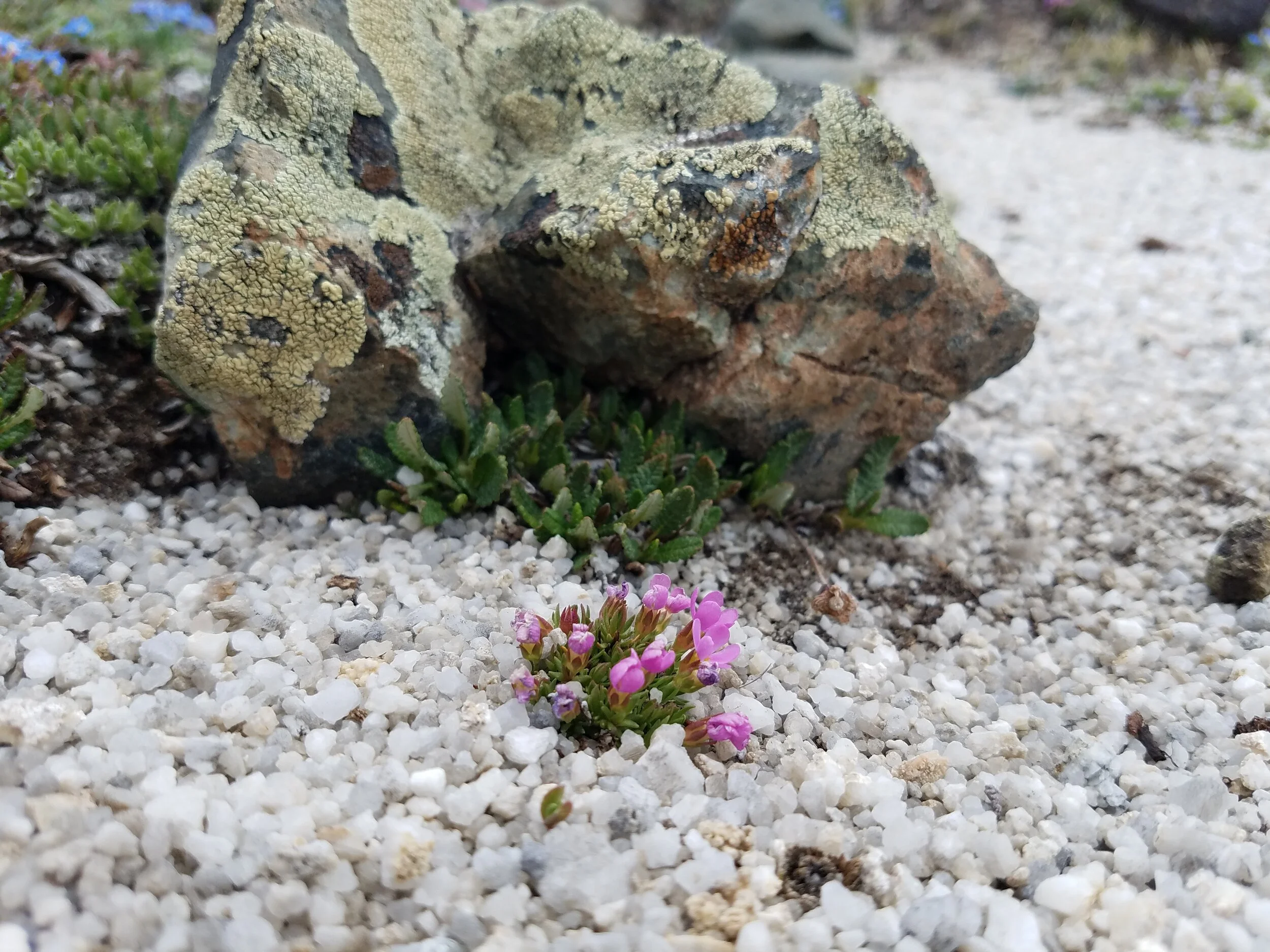


Elkhorn Peak was a pleasant surprise as the highest peak in the Elkhorn Range south of Boulder, MT. The trailhead takes you through the half-ghost, half-occupied town of Elkhorn. The trailhead is not exactly obvious & skirts private property. We passed through one gate, ostensibly to keep out motorized vehicles. The trail itself is a modest dirt road climb in the woods until the path opens to a surprising chunk of beautiful cream-colored quartz. Alpine Forget-Me-Nots & Deglacia are climbing up out of what looks like sea salt with a backdrop of lichen coated boulders. Obviously I spent a lot of time crawling on the ground to get macro photos of the scene.
From there the trail peters out & it is a short and obvious climb up sharp talus to the summit of Elkhorn. The summit provides spectacular 360 views of mountain ranges from the Crazies to the Pioneers to the Swan to the Front. I think we counted at least 9 different ranges. We would have stayed there all day if not for the rainclouds.
The traverse to Crow looks basic, however, is an incredibly unpleasant walk through what seems to be endless sharp & ankle-twisting boulders. The view from the summit is fine, but subpar compared to Elkhorn and not worth the hassle to get there. The descent resulted in a lot of pain to my arthritic foot and a lot of profanity. We’ve been on much worse descents, but this one really wasn’t much fun.
We found a “social trail” which was really an old mining road with sections of cobblestone still intact! That was quite the curious path, although a bit eery at times as it passed through a dense & quiet forest. We reached a section of dilapidated structures when we heard gunshots. It is very unnerving to be in the middle of the woods and not know where gunshots are being targeted (and it was definitely not hunting season). I wouldn’t put it past some off-the-grid nut job to shoot us either. Sure it was probably “just target practice” but ugh. Needless to say we didn’t get shot.


After finishing our hike mostly unscathed & gulping down Ibuprofen, we continued up a dirt road to the Elkhorn cemetery. The cemetery is well-maintained on a steep-ish hill & a placard tells the story of a diphtheria epidemic that started in 1888 and killed a large portion of the town’s children. Therefore, most of the gravestones in the cemetery are those of infants & children. Many are unmarked. It is a somber place & one that I would encourage anti-vaxxers to visit.
We stopped at a few of the buildings in “downtown” Elkhorn that are open to the public including an old dance hall. There we enjoyed the general creepiness of the buildings and graffiti that kindly points you to the direction of ghosts.
6. Koch & Imp Peaks


We (sort of) climbed Koch twice this summer. The first try I was feeling lethargic due to medical issues but we made it up the north ridge before being cliffed out by the notch (notch on Koch). A lot of people ski this in the winter. Good for them, but yikes, that notch looks steep! Needless to say, not the right way for us to go. It was still a gorgeous day with striking strips of snow layered on top of bright green grass & pink Monkeyflower.
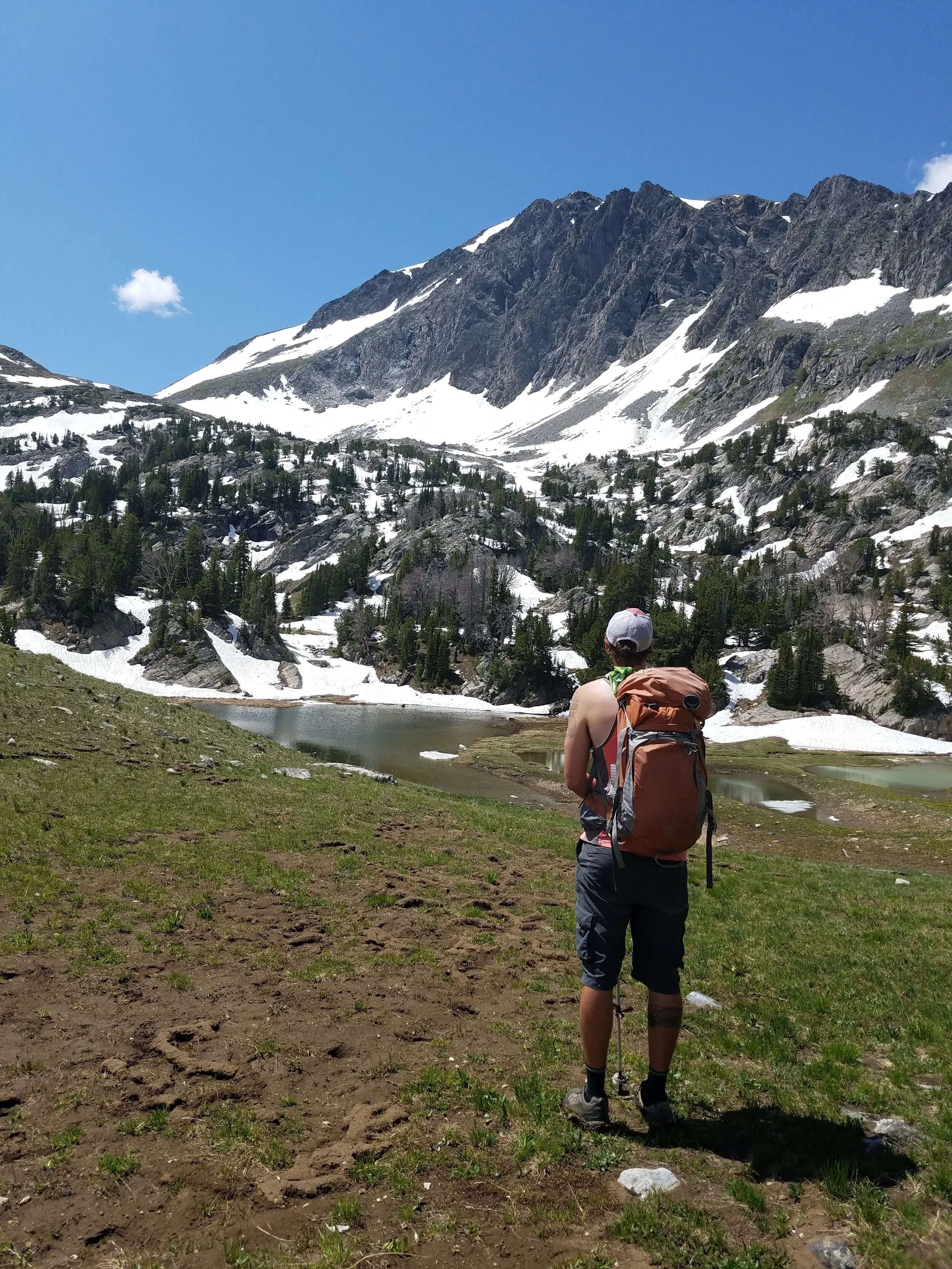
Koch & Imp are both located in the Taylor Hilgard section of the Madison range. The gatekeeper, if you will, to both mountains is crossing the Taylor Fork Creek. This crossing is only a mile or so up the trail, so tends to be particularly chilly in the early morning & was quite swift & deep. Ryan crossed multiple times to carry our backpacks & me. I have gotten rather wimpy about cold water, so I appreciated staying dry.
The second time we came to the area was a few weeks later. We climbed Imp on Saturday & Koch on Sunday. Imp is significantly longer at roughly 19-20 miles with 4000 feet in elevation while Koch is a rather mild 14 miles also with 4000 feet in elevation. We were certainly a little sore by Monday.


The trail to Imp itself is dull, but the reward is arriving at the Alp Lakes basin below Imp’s sharply pointed summit. The off-trail ascent beyond that is steep & rocky. After being in the 7.8 magnitude earthquake in Nepal in 2015, I often ask myself what we would do if there was an earthquake. Well, in the case of Imp, we’d simply be screwed.
The views from the summit are lovely—looking south to the lofty square of Echo Peak & the ruggedness of Hilgard Peak. Farther south, you can spot the Grand Tetons on a clear day. And looking north to Koch, Sphinx, and the rest of the Madison & Gallatin Ranges.
Imp technically has two summits & both are relatively easy to access with some minor route finding to the northern summit. Since we went up the seemingly never-ending gully of boulders, we descended the knife-edged ridge to the south. I would not recommend this on a windy day, as there are a few moves that require crab-walking or the like. We were fortunate to have a calm day.
We ran the last mile or so to avoid being completely destroyed by mosquitoes. Toxic level Deet & all of our clothing layers did not seem to deter them.
That night we drove all the way to Big Sky for a late dinner before returning to the trailhead to camp in our car. I think we would have scrapped our plans for Koch, but we were already at the trailhead the next morning! This time we went around the basin to the east which is very easy & straightforward. The summit of Koch has similar views to Imp, however, it looks down into one of the most lovely unnamed basins we’d ever seen to the west.


We fell in love with this area despite the cold creek crossings, murderous mosquitos, lengthy talus fields, and bear-anoia. This is another area that is prime bear country (or “bear-y” as someone mentioned), but we didn’t see bears or bear-sign. We also covered roughly 34 miles in 2 days and saw a grand total of 6 people. I think 2 of those people might have been the same person—a man who we spotted from summits of both peaks, who was roaming grassy hillsides below us with a dog. Not a bad place to be.
That’s Part I. More stories & photos to come…
“Our kinship with Earth must be maintained; otherwise, we will find ourselves trapped in the center of our own paved-over souls with no way out.”—Terry Tempest Williams, Finding Beauty in a Broken World