Part II: More Mountains & Such
Continued from Part I…
Since writing the introduction to Part I, we have attended the 2019 Montana Racial Equity Project conference which included an incredible panel on environmental justice. Some of the “homework” included readings & support of various organizations. Obviously this is just a start…
The Trouble with Wilderness by William Cronon
What makes a mountain, hill, or prairie a ‘sacred’ place for Native Americans? by Rosalyn LaPier (a panelist at the conference). She talks about Chief Mountain in this piece, which is both striking & humbling to me. We never considered these things (like asking if it is okay or not eh hmm white privilege) when we climbed Chief years ago, but I felt really unwelcome on that mountain like we weren’t supposed to be there. Now I know we weren’t.
As Long as Grass Grows by Dina Gilio-Whitaker (book)
Soul River, Inc. (“Like” them on social media and/or check out their website & work). Soul River, Inc. is a “nonprofit 501 c3 focus on bringing veterans as mentors and inner-city youth together into the wild rivers of nature inspiring the youth by becoming a guardian, teacher or role model as an act of service into the outdoors…” Chad (the founder), accompanied by his service dog, Axe was on the EJ panel as well.
Check out the Living Landscapes Climate Science Project from the Salish Kootenai College.
Watch 100 Years documentary on Netflix which is the story of Elouise Cobell’s fight for justice in Indian country. This is truly an excellent film & important history.
I need to work further on my own EJ issues homework. I also appreciated many of the comments/conversations from the panelists, including from Kiersten Iwai who made a statement on how we need to be truly honest about why we want to protect certain places—ultimately we want those spaces for ourselves. She said it more eloquently, but it is so simple & so very true.
And with all of that in mind, continuing on to part II…
7. Rising Wolf & No Chief Mountain (aka Flinsch peak)


Ah, to be back “home” in Glacier National Park. As an additional reminder from part I, GNP is also Indigenous land—Nitsitapii (Blackfeet), Salish, Kootenai, Gros Ventre, Cree, and other tribes. As much as I love GNP, the history behind the creation of the park is ugly similar to many other parks. It doesn’t take away from its specialness as a place, but history & attempted erasure of Native folks (past & current) can’t be ignored. There are a lot of resources out there on the subject. On a truly hopeful note, the Blackfeet are aiming to open their own national park which would be fantastic.
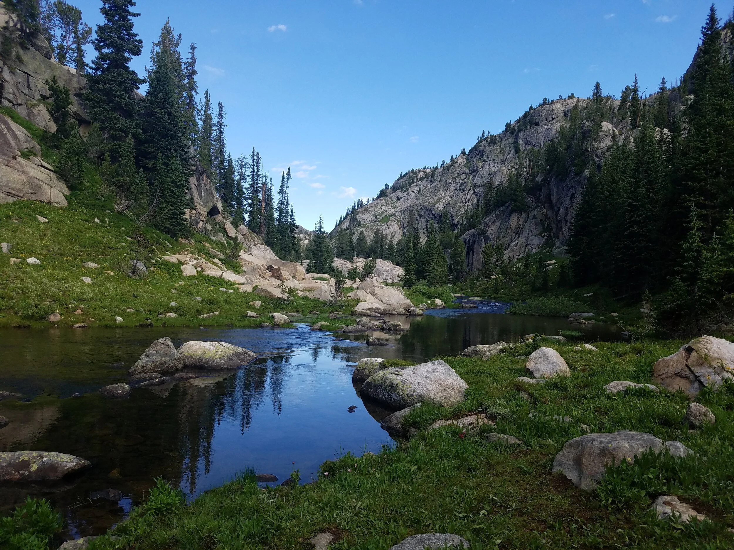
Rising Wolf & No Chief (the latter name I only just researched as I’ve always known it as Flinsch & not to be confused with Chief Mountain) are mountains we’ve climbed before several times. Rising Wolf dominates the northern shore of Two Medicine lake, while No Chief is a pyramid-shaped peak at the head of the lake. (Oh no, I sound like a damn boat tour!) Ryan & I met at the Two Medicine area of the park back in 2006 and both worked on the boat crew for years separately & together. So, of course, this place means a lot to us as it does to many others. But, really, it isn’t that nice. Try Old Faithful.
But onto the peaks…we climbed Rising Wolf from the easier but longer route from the North Shore trailhead & Dawson Pass. It was a clear, beautiful day in the park and we had the summit to ourselves for at least 20 minutes before a bachelor party showed up (I was rolling my eyes hard but fortunately they weren’t too obnoxious). Then we trekked back across the ridge between Rising Wolf & No Chief (which is much longer than it looks—roughly 3 plus miles) & climbed the latter peak. We discussed that it was actually easier to climb both peaks than to side-hill down from Rising Wolf directly to the pass as we had both done in the past. It is a long day at around 20-ish plus miles but we were greeted by our friends in the campground & felt nothing but tired and happy.
Two Med is full of fun stories & we were happy to spend the time with many ‘old’ friends. It is always interesting to share campground restrooms with other people—especially a lady who plugged in an espresso machine in the bathroom and while waiting for her coffee, casually placed an index card with an inspirational quote (or bible verse?) in front of the sink while I was brushing my teeth. We did not, however, see any cats on a leash this time.

Bison burgers & veggies.
8. The Beaten Path


The Beaten Path is the unofficial name for a trail that goes through the Beartooth Range. We hiked the 26 plus mile hike from Cooke City to East Rosebud Reservoir & chose this direction due to the relatively easy elevation gain and longer elevation descent. There is a lot of car shuttling involved unless you can coordinate a key swap with another hiking group going the opposite direction. Unfortunately, we needed to do the former plan with two cars, which resulted in Ryan going from having never gone over the Beartooth Highway to four trips over it in one weekend. The road itself is beautiful & often chilly with the highest elevation at just over 11,000 feet.
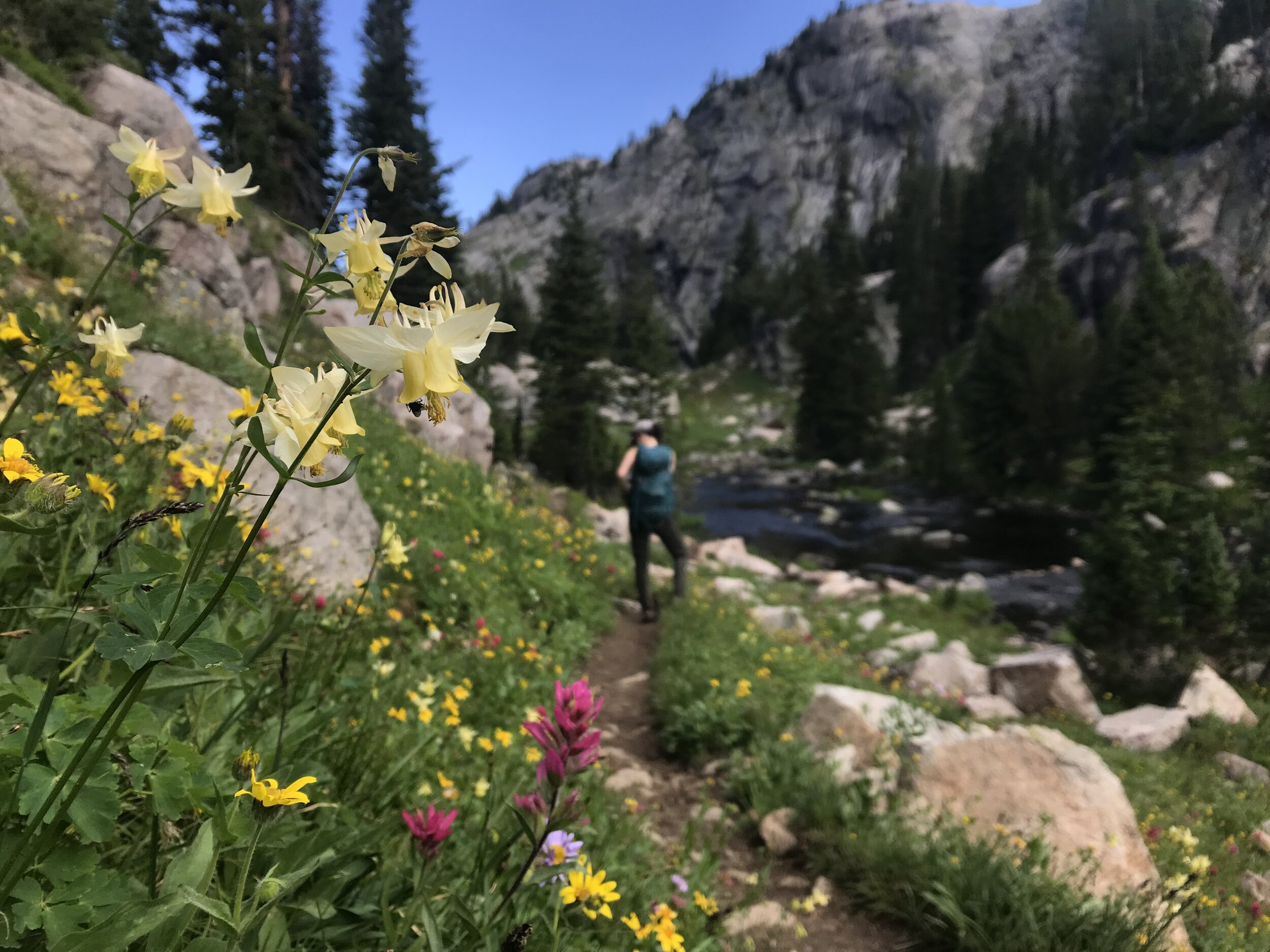


Once in Cooke City, we decided to ditch car camping for a quirky room in a shared cabin due to rainy conditions. We woke up at five and started on the muddy but mosquito-free Clark’s Fork trailhead. The first half of the hike was a gentle climb through open, misty, quiet woods, then passing endless calm lakes, and golden, sunny alpine meadows. We started passing more folks (mostly backpackers) on the 2nd half of the hike (hence the name, The Beaten Path). While popular, it was certainly not overwhelmed with people.


The Beartooth Range is notorious for a short hiking season due to late spring & early fall snow. There are also some impressive winds & afternoon thunderstorms which we experienced on two previous trips to climb Granite Peak, the highest mountain in MT & located nearby (though never visible from the trail itself). We were fully prepared for lightning or at least rain, but somehow had only sunshine & a few clouds. I even changed into shorts. There were so many mountain views, alpine flowers, lakes, and waterfalls that we stopped taking photos of all of them (although we took lots of photos as you can see & in no real order). The views were so dizzying, in fact, that we completely missed a nanny goat with her kids. We only saw them later in a picture!
The last five miles or so were hot & dull, or we were just tired and ready to be done with the hike. I was getting so hangry that I nearly stepped on a snake and didn’t notice (Ryan told me later & smartly not at the time). When we were almost out at the East Rosebud trailhead, we were just feet away from a small black bear running across the trail. All in all, it was a lovely long day & we were perfectly satisfied with not carrying the backpacking weight, plus we had just a one-day window of great weather in between the rain, storms, and a microburst warning! I’m not sure how we lucked out on missing all that.
When we were done, we celebrated the day by eating an abundance of food in Red Lodge. For breakfast the next morning, we ate at Cafe Regis with outdoor seating out back next to a colorful greenhouse. We highly recommend it!
9. Mt. Borah (Borah Peak)
Mt. Borah or Borah Peak (depending on the source) is the highest peak in Idaho at 12,662 feet. Since it is on the 50 high points list, it is a popular climb & there are numerous online accounts ranging from the more mundane to writing that makes it sound akin to scaling K2 (it’s neither). Borah is located south of MacKay (pronounced Mack-ee by locals), which is a weird little town with a biker bar, ATV rentals/self-guided road tours, abandoned old barns, a reservoir, and not much else. This is Idaho. We stayed in this great, but slightly creepy old farmhouse Airbnb complete with a coal-fired stove in the basement and a tire-swing out front.


We started on the trail at 0530 am and we were by no means the first to start hiking that day. The trail climbs rather steeply (5,242 feet overall in 3.5 miles). As we climbed we were treated to a gorgeous sunrise & despite the early morning & cold air, we were soon down to our tank tops and moving quickly. These mountains are arid & you need to carry all the water you need as there is no source, although we still carried too much. The crux, if you will, is Chicken Out Ridge (where many folks turn around). If you’ve done any scrambling before, this was rather cut and dry. However, we missed the trail on the north side of the ridge and instead went over the top of the ridge which is somewhat knife-edged and understandable why folks would be a bit nervous (I was in places). That route was okay for us, but not necessary as we discovered on the way back there is an easier, more commonly taken route. That said, the latter route does require crossing an icy snowfield, which seemed to be the most treacherous part of the hike. And, on the flip side, the route up & over avoids most other people.


We reached the summit at around 9 am and it was glorious but absolutely frigid. I was happy to have my down coat & not jealous at all of the trail runners with their ultra-light (aka not warm enough!) layers. We ate a peanut butter cookie for our second breakfast before descending. We spent a few hours sitting by the reservoir outside of town, reading, & eating processed sugar. We did swing by Craters of the Moon on our way home from Idaho the next day, which was fine for a quick trip but also a bit boring after seeing Hawaii Volcanoes. I would probably give it 3 stars on a Yelp review, just saying.

To be fair, Craters of the Moon did provide for some otherworldly looking photographs.
10. Holland Peak (almost)


Holland Peak is the highest mountain in the Swan Range. It too has a trail, although not as official as the Borah trail. In fact, there is a long-winded & slightly dramatic Forest Service sign warning that the trail is not official and people have died on the route. I’m sure that’s true, but they really don’t want responsibility for this one! Although the elevation gain is apparently similar to that of Borah, the trail up Holland seemed somehow steeper. It could have been that we were really tired & the weather was not as promising as the forecast suggested, with sprinkles of rain and clouds. The trail was fine, just not maintained, so there is more brush to push through at times but otherwise straightforward.
When we reached the second lake, we felt how windy it really was but we continued on. We were only about 500 feet or so below the summit, but we still needed to cross an exposed ridge. I watched a trail runner in front of us crawling/clinging to the rocks as she & her partner then ascended into a cloud towards the summit. We decided to turn around due to the wind making the scrambling/ridge crossing sketchy as hell. It was disappointing, especially after doing most of the work & since other people were doing it (I know, I know, we were probably smarter for turning around). We will have to do a re-do on this one. We won’t be staying at The Wilderness Gateway Inn in Seeley Lake again though. That’s a weird place.
11. Mt Blackmore


Blackmore is a straightforward mountain with a trail to the top gaining about 3,746 feet in elevation to the summit at a little over 10,000 feet. I have traditionally started from the Blackmore trailhead which starts prior to the Hyalite Reservoir. It is shorter & even easier to take the trail from the reservoir itself as my dad discovered while studying a map. My dad & I had a perfect late summer/early fall day with almost no people on the trail it being a weekday and all. Actually it was surprisingly quiet since this trail is a popular one. Any of the areas in Hyalite are plain gorgeous in the fall, with the meadows turning to a soft golden hue. Blackmore remains one of my favorite close-to-Bozeman hikes & I was happy to share the day with my dad (despite a fall on the summit while trying to get a photo of the two of us) while my mom picked huckleberries by the reservoir.
12. Blackleaf Canyon & Tattoo Mountain


My dad dropped us off at the trailhead & we had Blackleaf to ourselves on a crisp autumn day with no climbers to be seen on the sheer cliff wall entrance to the canyon. The trail snakes between Warner & Frasier peaks before a flat meander through aspen & spruce & crunchy shrubs & grasses. The trail was overgrown and petered out at times, but it didn’t matter, because I always know where I am in this place. The mountain at the head of the canyon is unnamed, but it is tattooed on my arm & therefore apparently Tattoo mountain. It is lower in elevation but provides a unique eastern view back down into Blackleaf. We stayed on the summit as long as possible, looking in all directions and trying to name the mountains we know & have climbed. Even though I grew up here, the mountains are somewhat less distinct than say, those in Glacier. It was such a perfect day, minus the stretch of uphill scree climbing which can be exhausting.
We scree-skied down (much more fun than up!) the western side of the peak & found the trail with relative ease. This side was burned in the 2007 fire, but the black-charred trees and newer undergrowth with bright reds & yellows were a dramatic sight. We met up with my dad further down the trail and came out at the West Fork of the Teton. Days like that I could re-live hundreds of times & never tire of.
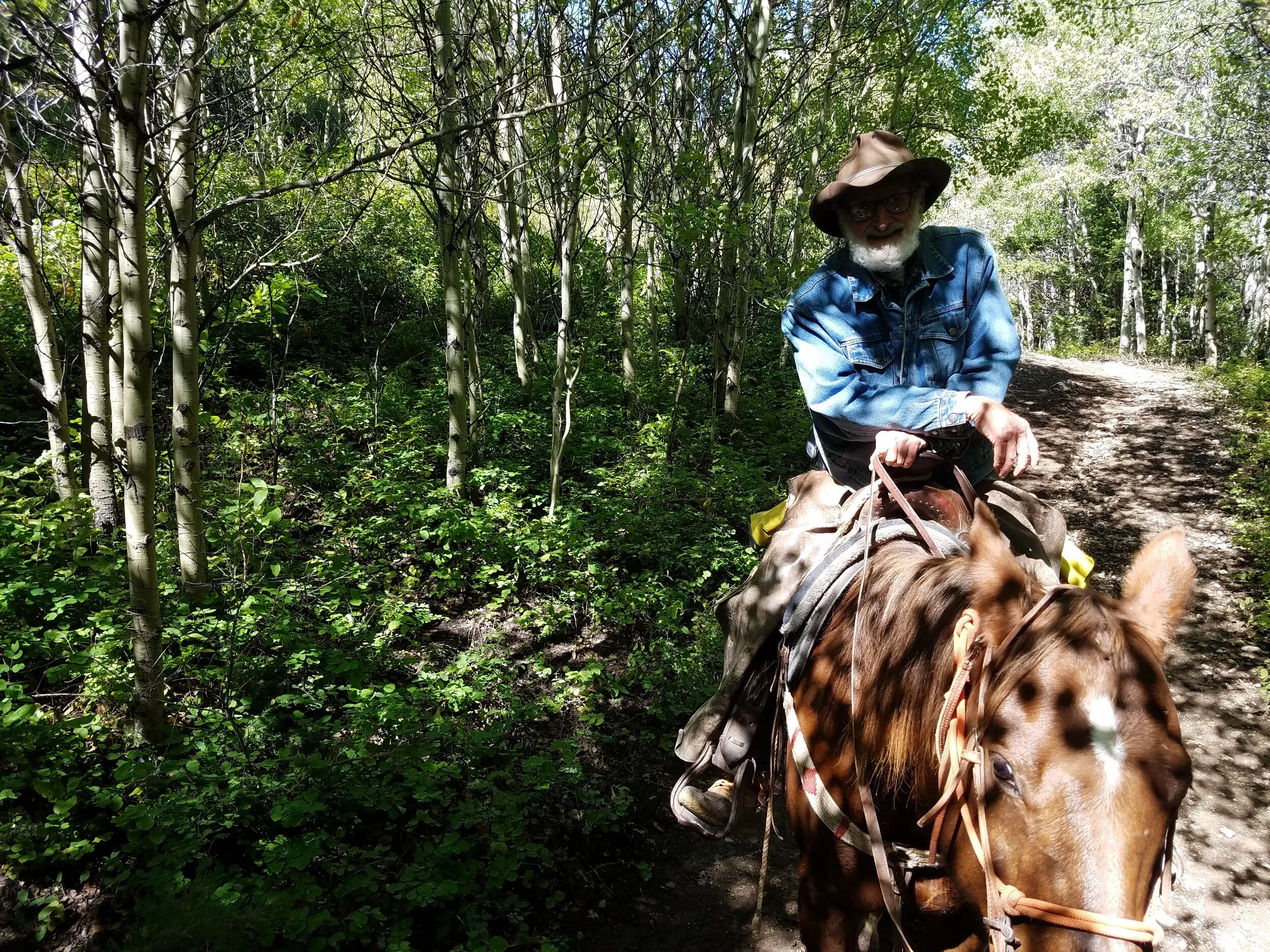
Just a week or so earlier, I went horseback riding up at the ranch, which was a short but sweet fall highlight. I wanted to take my horse for the day, Lefty, home with me. But then, horses are a lot of work, so I was happy to just borrow him. I do love horses.


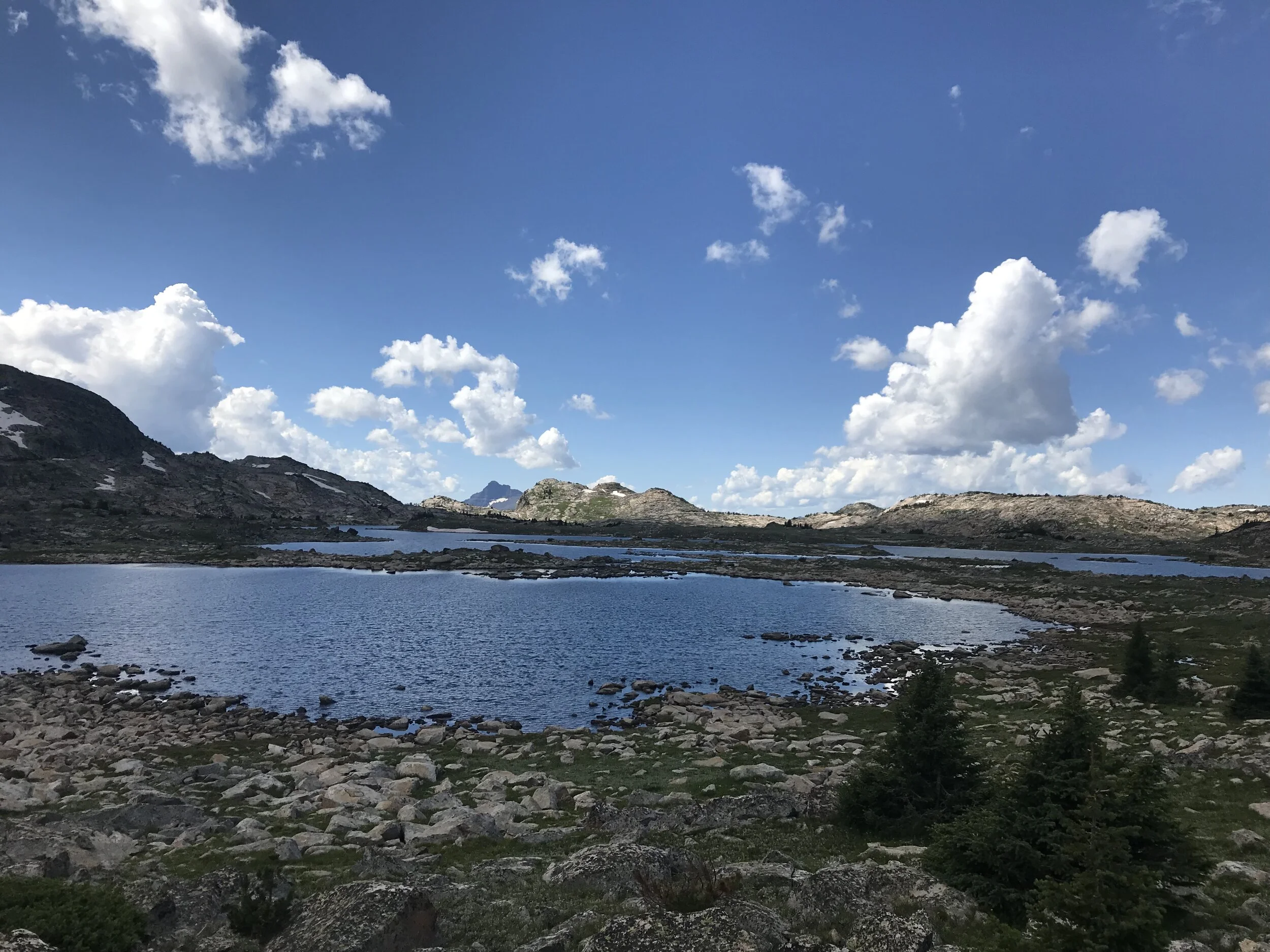
13. Hilgard Basin & Echo Peak


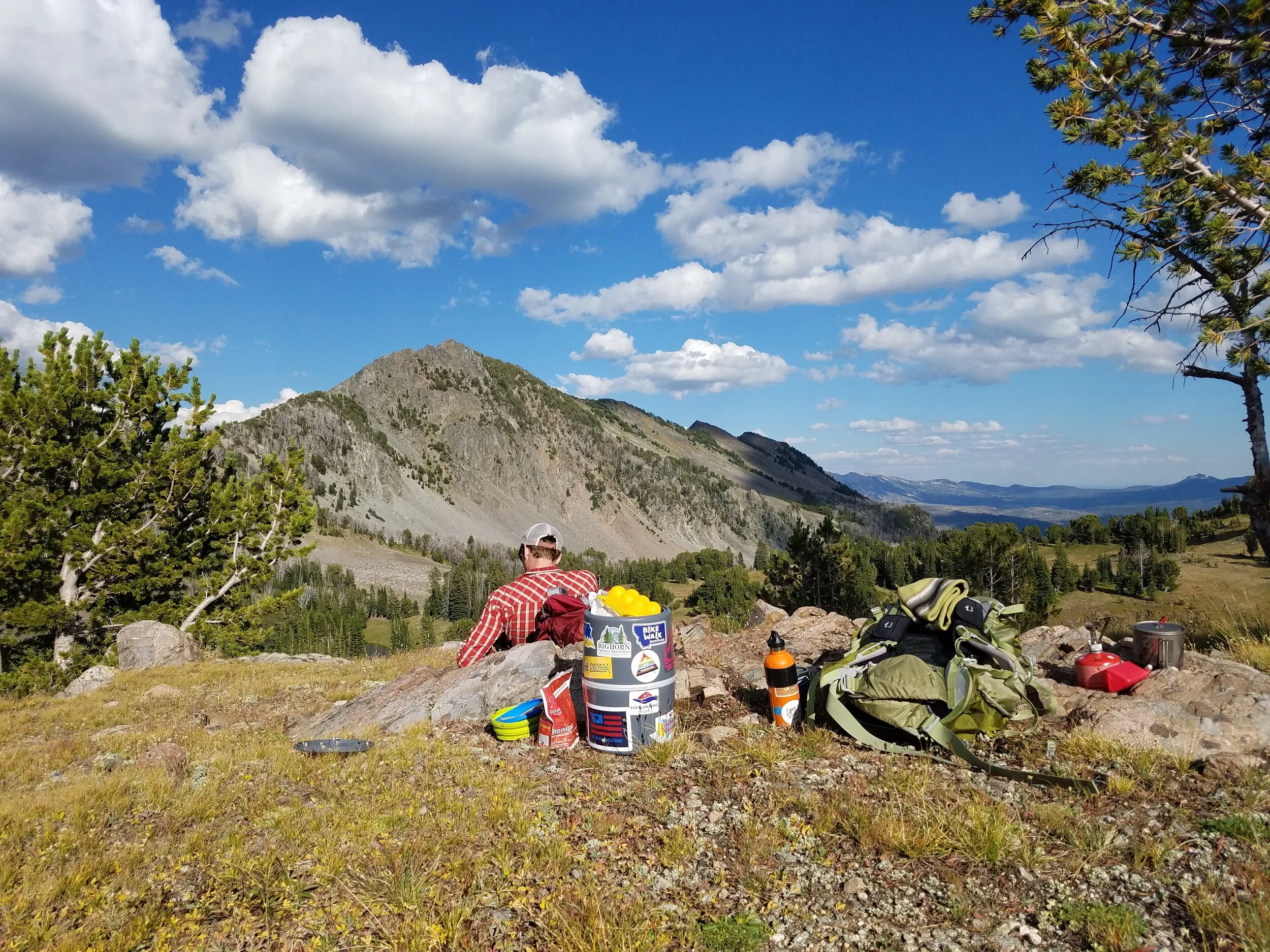

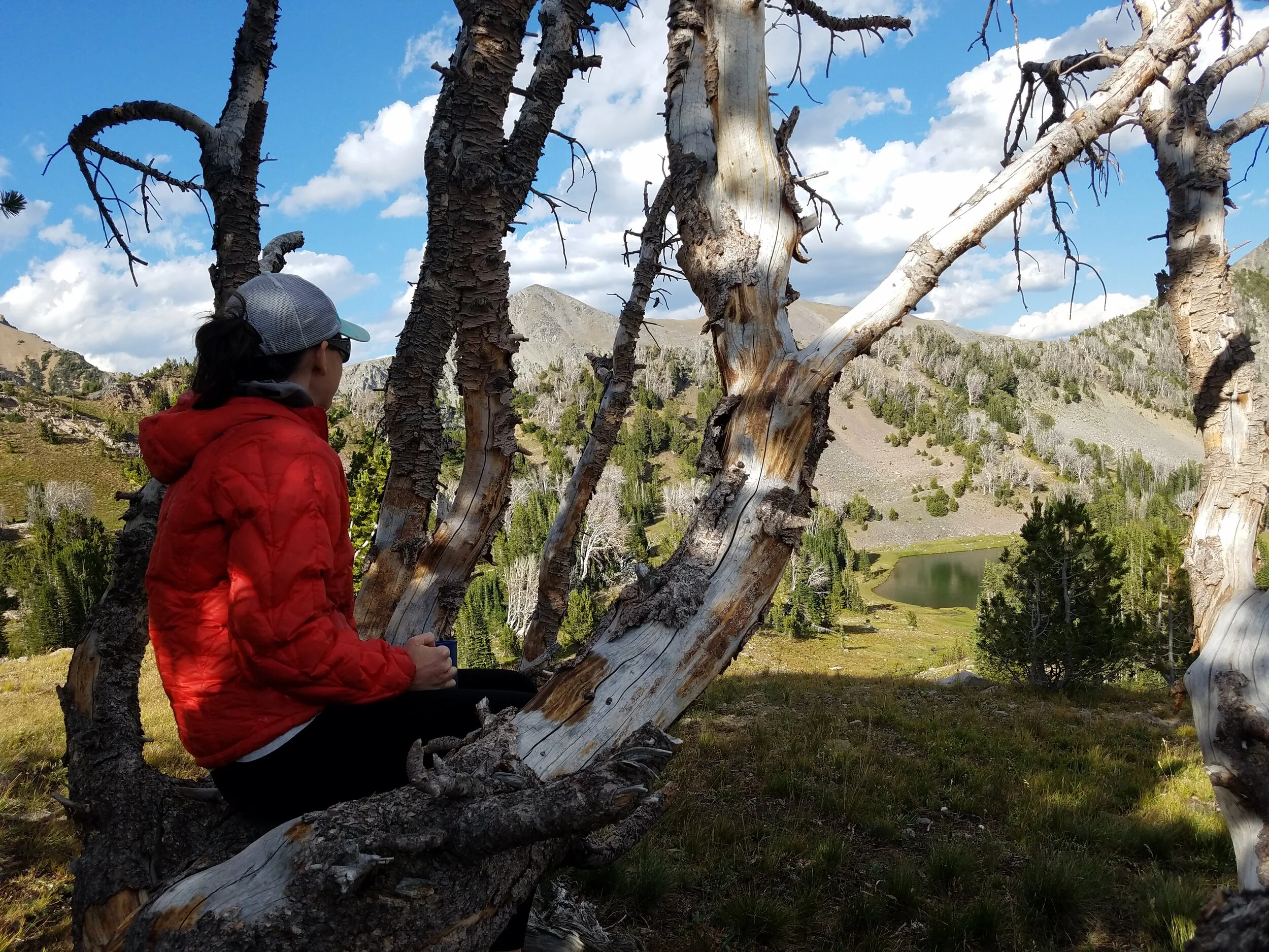
Hilgard Basin is a well-known basin in the Taylor-Hilgard unit of the Lee Metcalf Wilderness to the south of Koch & Imp peaks which we climbed earlier in the summer. We really spent some quality time with the Southern Madison Range this year! The trail is accessed from Beaver Creek Road off of Quake Lake. This was our one & only backpack of the summer which meant that my shoulders & back were not prepared for the extra hiking weight. The Sentinel Creek Trail is not particularly interesting as it climbs for 6-7 miles in the woods before popping out into alpine meadows with what seems like endless little streams & multi-colored blue/green lakes. We happened to score an idyllic campsite, complete with our own overlook of the basin, unnamed lake, and limber pine skeleton to sit in like a throne. We splurged on some fancy-ish backpacking meals & ended the night with Fireweed whiskey & chocolate brownies. You can’t get much better than that.
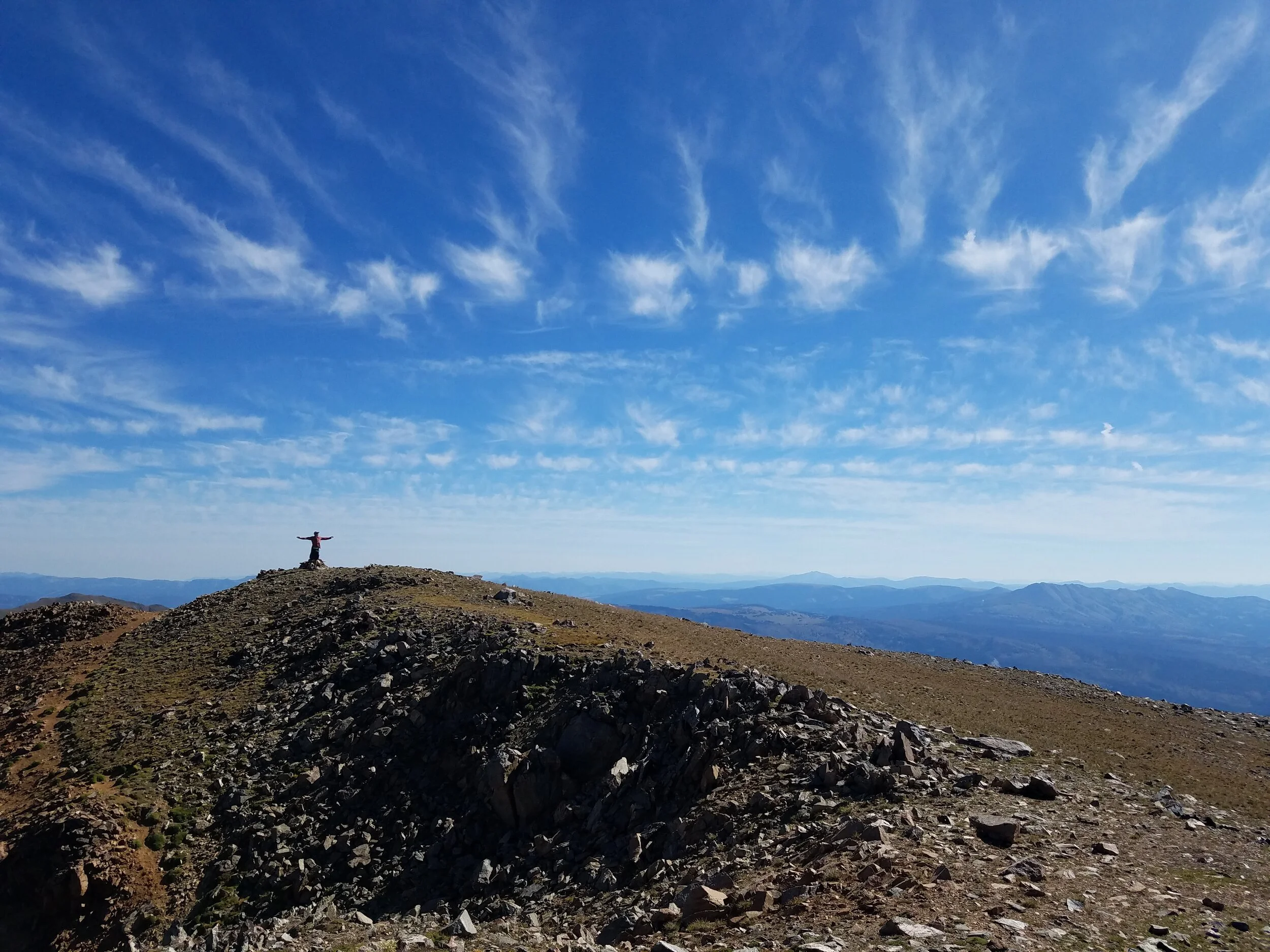
The next day we climbed Echo Peak, which is 11,225 feet, but very easily accessed from the basin & essentially a steep hill walk. Once again, we had incredible sunny weather with splotchy & photogenic clouds. We had an excellent view of Hebgen Reservoir & the Grand Tetons in Wyoming as well as the rugged sharpness of Hilgard Peak. Ryan quickly jumped in & out of “our” (freezing) lake after the hike before we set off to explore more of the basin.


Although there were a lot of other backpacking groups, horses, dogs, and even an older couple skinnydipping in the main lake (which caught us slightly off guard)…the basin was still mostly calm and spacious.
It was a lovely, although physically painful (I really don’t like the carrying a backpack part), end to our summer. Of course, we did a few smaller hikes on the weekends following & even (accidentally) rescued a dog that had been roaming the Bridgers for six days. I miss Montana summer already.
And now on to new adventures…